The Placemaking Round-Up
A biweekly newsletter with public space news, resources, and opportunities.
The Biweekly Bazaar
A curated dispatch on all things public markets plus the latest announcements from the Market Cities Program.
A biweekly newsletter with public space news, resources, and opportunities.
A curated dispatch on all things public markets plus the latest announcements from the Market Cities Program.
By Steve Davies, Fred Kent, and Kathy Madden, Co-Founders of Project for Public Spaces
What were we thinking? In retrospect, it was a pretty brave (and audacious) thing to start an organization dealing with public spaces 50 years ago–especially when our most frequently asked question was, “What’s a public space?”
Applying the techniques that Holly Whyte had pioneered to improve public spaces was the easy part. To make a living, we found we had to first convince potential clients that there was a problem to be solved. That’s how Project for Public Spaces became both a technical assistance provider–and a thought leader and educator, a role that has continued to evolve. As we gained more knowledge from our project work, we translated those lessons that could be more broadly applied. Hence, the 11 Principles for Creating Great Community Places! In honor of the 50th anniversary of Project for Public Spaces, we wanted to reflect on these 11 principles because it's a great way to share some stories from the organization's early days and describe the origins of these ideas, which are still used to communicate how to transform public spaces today.
The 11 principles were initially published in the first edition of How to Turn a Place Around in 2001, although they had been incubated for many years before then. They became staples in our presentations and training programs, and in 2018, they were further evolved as the framework for the second edition.
We developed these snappy, easy-to-remember principles to make information about public spaces accessible and usable to non-professionals, just as William “Holly” Whyte did in his groundbreaking book and film, The Social Life of Small Urban Spaces. It’s an important part of our legacy that these principles—along with the Place Diagram and the Place Game—are still used worldwide and have been translated into countless languages. We also studiously avoided planning jargon, and Co-Founder Kathy Madden was an especially ruthless editor with a knack for shortening long paragraphs into one or two simple sentences.
Today, we still strive to communicate placemaking ideas in concise and fun ways. After leaving Project for Public Spaces in 2018, we founded the Social Life Project as an homage to Holly’s documentary and his Street Life Project before that, where Founder Fred Kent cut his teeth. Over the years, we have continued photographing people and public spaces, and this rich archive provides the visuals for over 100 photo essays on how people use public spaces and how public spaces can transform communities.
We love telling stories, but hearing stories is even better! Do you have reflections on public spaces from the past fifty years that you want to share? Did work with Project for Public Spaces as a client or partner? Did you attend one of our conferences or trainings? Email media@pps.org to share your memories for a chance to be featured in our storytelling!
While Project for Public Spaces was founded to continue Holly Whyte's pioneering observational methods to study how people use public spaces, we soon started to add surveys to engage users more directly about how they thought a space could be improved.

Our first survey was in 1978 on a project to improve Restaurant Row on West 46th Street in Manhattan’s Hell's Kitchen. The project helped stabilize the neighborhood from the decline of nearby Times Square and supported more than 20 restaurants on the street. With the assistance of the local block association, we went door to door, up and down the stairwells of tenement buildings, learning more about the street than we could ever do just by observation alone.
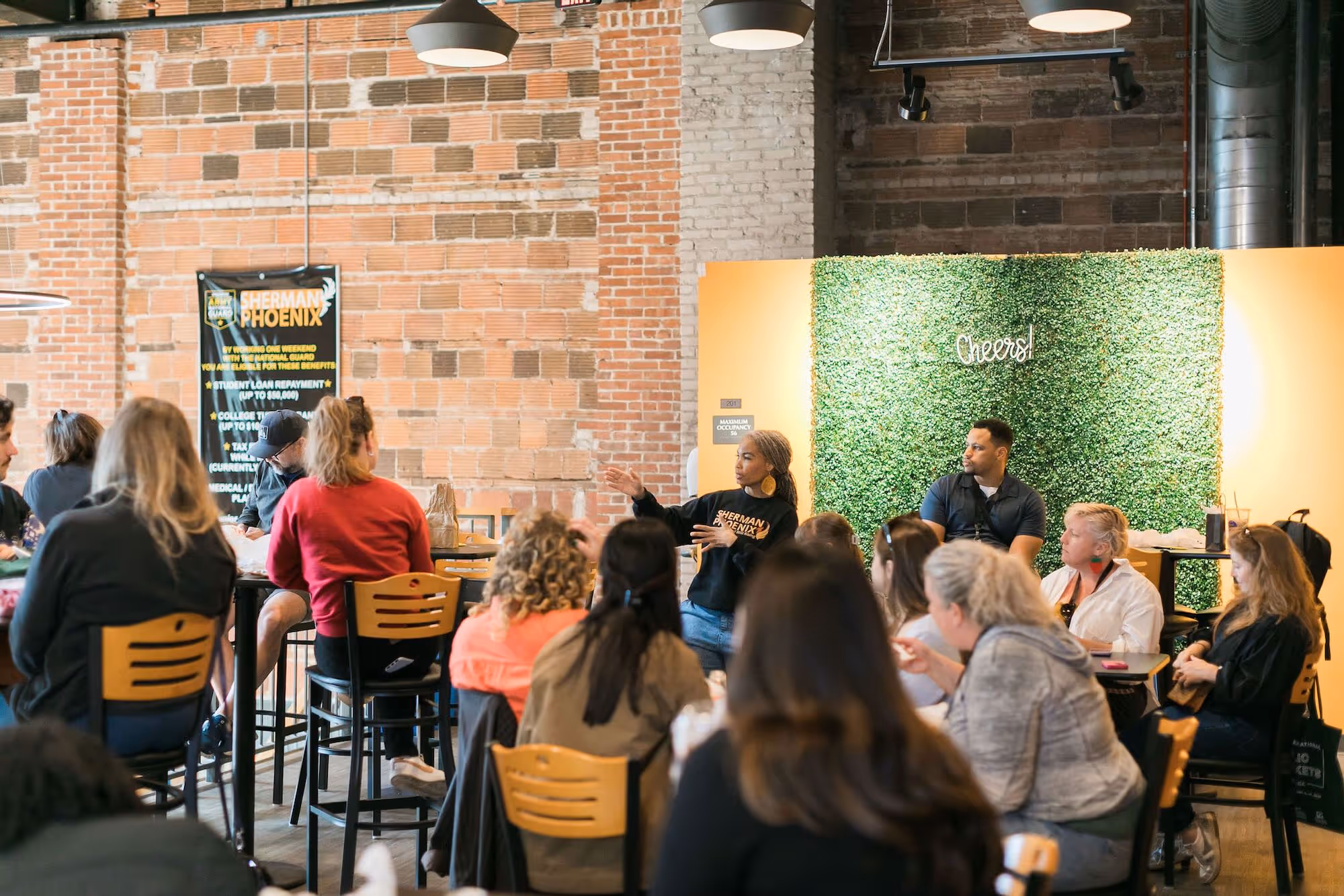
As our projects grew in complexity, we also began to host interactive community workshops, inspired partly by Michael Doyle and David Straus’s insightful 1993 book, Making Meetings Work. This book provided a framework for us to structure “placemaking workshops,” where people are broken into small groups that evaluate different areas of a public space together using the Place Game and then prepare a presentation of their findings and recommendations to everyone at the workshop. We had stumbled upon a very powerful technique—the game gives people the framework for observing a public space and gives them the confidence to trust their own valuable insights into how the area functions and what it means to them. As a bonus, this was also much faster than conducting days of observation and filming, Holly style!
Tapping into community knowledge and expertise at the beginning of the placemaking process helps create a true sense of community ownership and control. That’s why we say the community is the expert—not the professional architects, designers, and transportation engineers who are usually treated as “experts.”
In our original 1975 prospectus where we proposed the founding Project for Public Spaces, we wrote, “Our experience has indicated that the design and use of urban public spaces requires a perspective broader than that of the architect or designer. We believe in an interdisciplinary approach.“ One article in the 1980s called Project for Public Spaces, “The Space Doctors,” recognized our role in fixing public spaces that had been designed but were not working for people. (The second part of this principle, “not a design,” is an intentional cautionary warning.)

We didn’t start using the word “place” until the mid-1990s, however, when we were asked to define “livability” for a Transit Cooperative Research Program (TCRP) research project. In the process, we discovered a whole body of research around livable “places,” and that's when we first consciously made the connection to “public space,” and ultimately to “placemaking.”
One day, as part of this project, we sat around the conference room table with a big flipchart paper in the middle. At the top, we wrote, “What Makes a Great Place?” Initially, we thought we’d just do a list, but we ended up drawing a big circle divided into four quadrants—the beginning of the Place Diagram! That moment was a turning point for the organization. The place diagram gave us both an analytic and communication tool that summed up pretty much everything we knew about public space.
The most important learning about this new tool? Many of the key characteristics of successful places cannot be achieved by a designer alone. Uses and activities need programmers, comfort and image need caretakers and artists, access and linkages need marketers and transit operators, and sociability needs all of us.
We discovered early on that there is no magic funding stream for improving a public space and that partnerships were essential to getting anything done. One early project demonstrating the power of partnerships was Museum Mile, the section of Upper Fifth Avenue in New York City that is a cluster of some of the most important museums in the world. But people didn’t recognize this asset until we literally stopped traffic for a now-annual street festival billed as the “best block party in NYC,” and put Museum Mile on the map (eventually emblazoned on every street sign in the district). The museums, which had previously had little contact with each other, discovered there was a lot of benefit to working together, and they are still doing it 47 years later!
We also applied this principle to our organizational structure. In the early 2000s, we restructured the organization around programs in transportation, public markets, parks and plazas, public buildings, and new developments. By shifting focus away from one-off projects, we were able to enter into strategic partnerships with foundations, federal agencies, and other national organizations. For example, in the public markets program, we launched a three-year, $3 million program in 2003 with the Ford Foundation and the W.K. Kellogg Foundation, which provided funding to enable markets to focus on developing their own partnerships and expand their impact on the community. This grant program—one of the first ever for public markets—inspired the creation of the USDA’s Farmers Market Promotion Program, which has awarded over $150 million in grants since 2008.
While “You can’t do it alone” started as a principle of our projects, it became a framework for almost everything we did. Perhaps the culmination of this principle was the creation of the Placemaking Leadership Council in 2013, where over 400 placemakers gathered in Detroit to discuss the future of placemaking as a global movement. Today, the PlacemakingX network we launched in 2020 carries on this mission, with over 25 regional organizations working together to advance placemaking globally.
This principle is another homage to Holly Whyte and his pioneering use of powerful observation tools like systematic behavior mapping and time-lapse filming. In The Social Life of Small Urban Spaces, he writes, “In 1970, I formed a small research group, The Street Life Project, and began looking at city spaces. At that time, direct observation had long been for a study of people in far-off lands. It had not been used to any great extent in the U.S. city.”

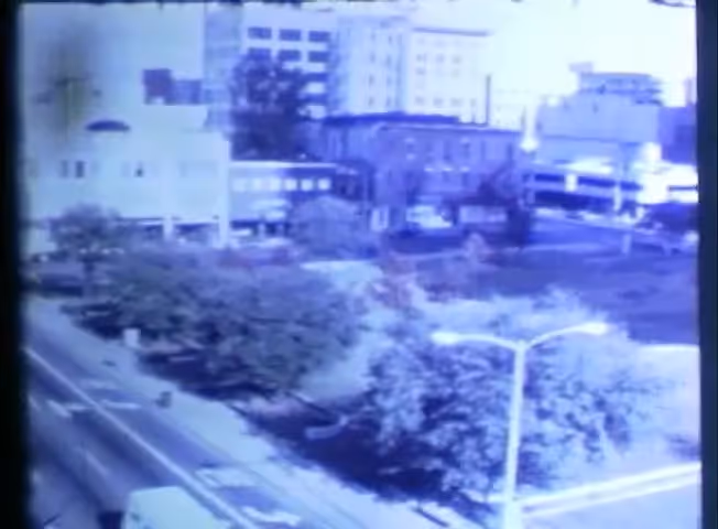
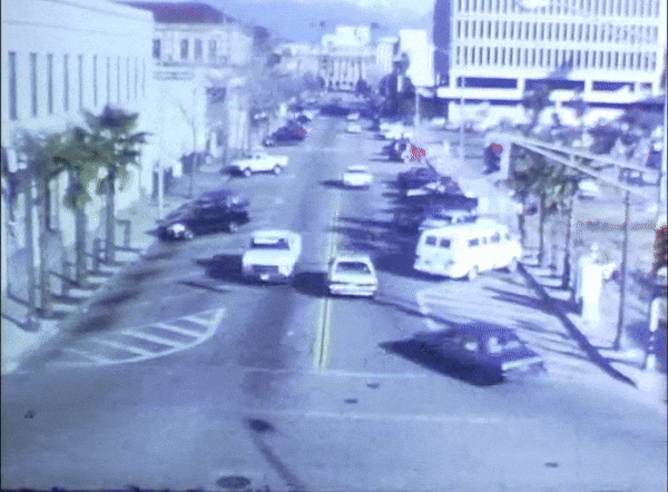
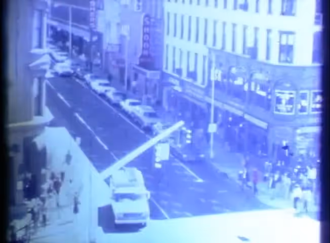
As we applied these techniques in other cities and contexts, we carted our clipboards, pedestrian counters, stop watches, behavior mapping forms, tripods, and movie cameras to scores of public spaces in New York City and beyond. One early success was a block from our office: the Exxon Mini-Park in Rockefeller Center. Management had erected a fence to deter drug dealing, which had come to dominate the space, but the fence only made matters worse by channeling pedestrians right by the dealers. We redesigned the park to add food stalls, movable seating, and a performance space, and that’s when we learned that drug dealers can be crowded out by adding a greater diversity of uses and users. The mini-park became the model for Bryant Park, as we followed the drug dealers around midtown.
In 1975, Holly became an advisor to Project for Public Spaces because he was busy finishing the research for his film and book, The Social Life of Small Urban Spaces, a brilliant example of Holly at his best: accessible ideas, persuasive data, great visuals, and very funny! Holly’s film was an enormous success, and people we meet remember it vividly decades after seeing it. Sadly, the version of the film long in distribution was a very grainy print and no one knows what happened to the original film. We are thrilled, however, that we recently found a good print of the film in our basement.
Inspired by Holly, film was core to everything we did in the early years of the organization. We used Super 8mm film, and at one point, we were one of the largest users of this film stock in the U.S., with two filmmakers on staff. Today, the film is stored in 25 large moving boxes and 4.5 terabytes digital video, which we hope will become publicly accessible someday.
We used film for analysis and to make our presentations. The cameras had a time-lapse function that enabled us to film a space for an entire day with only a few rolls of film. People move like Keystone cops, so it's easy to see flow patterns and how the overall use of space ebbs and flows over the day. As Kathy always demanded, we needed to define the issues we were studying before we filmed so we could pick the right location and time-lapse interval. (Kathy wrote a handbook, Film in User Analysis so that others could replicate our process.) We would then take documentary film of the space, make graphics that show our research results, and then combine this all with the time-lapse to create silent 10-15-minute presentation films, which would whir away on our portable Super 8mm projector while we orally presented our findings. (Narrating a silent movie–with no pauses for side comments–really keeps you on your toes!) While technology has become more digitized and automated in some ways, observation remains crucial to understanding how people really use a public space.
This principle was based in part on the biblical admonition, “Where there is no vision, the people perish” (Proverbs 29:18-19). In the early days, people had low expectations for their public spaces. We realized that we needed to elevate both people's understanding about how spaces work but also what they could become.
We designed our presentations as Holly might have—first on film, then with slides, and then in PowerPoint—to be both educational and inspiring, telling stories with compelling images, thought-provoking quotes (as the one above), colorful graphics, and before-and-after case studies that would encourage people to have a big vision for the potential of their public spaces. The presentation was often the setup for a workshop, and people would go outside in groups to use the Place Game to evaluate a space with the visionary ambition we just planted in their brains.
We loved showing quotes in our presentations and frequently used Holly’s quotes paired with a perfect image to get people thinking about the “vision” by humorously illustrating “lost potential.” An image of downtown Houston, which was particularly photogenic (in a bad way) always got a laugh from the audience when paired with a favorite Holly-ism: "It is difficult to design a space that will not attract people—what is remarkable is how often this has been accomplished.” Ironically, some of our best placemaking projects have been in Houston, winning the title of North America’s Placemaking Capital on our blog in 2011. Perhaps being the poster child for a terrible space made Houstonians more determined to do bigger and better!
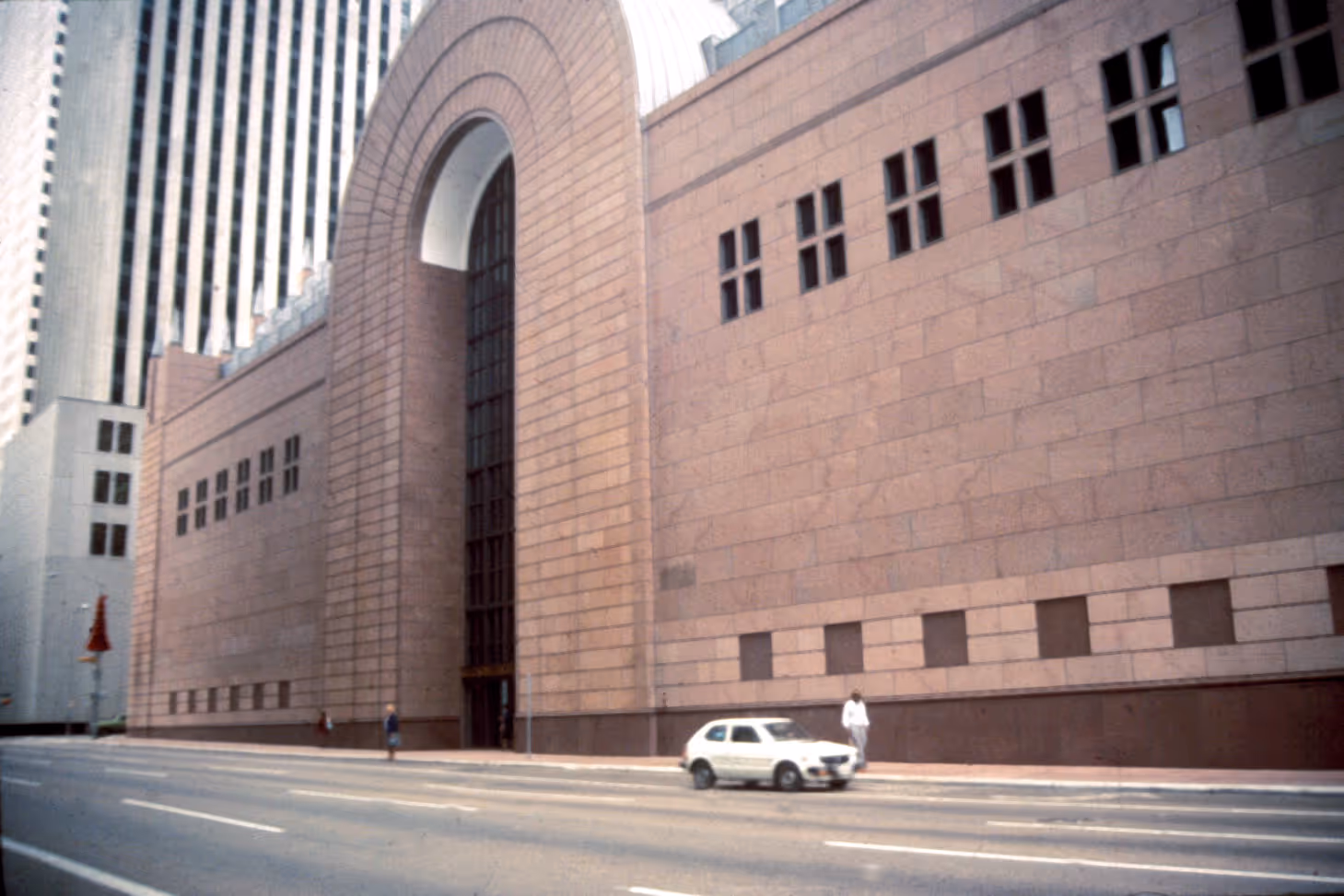
In the mid-1980s, we were invited to tackle one of the most ghastly urban megacomplexes of all time—Detroit’s Renaissance Center. Designed by John Portman to be six cylindrical towers linked by one giant circular walkway, the building literally had people walking in circles and getting lost. One entire floor designed for upscale shops sat vacant, and the complex with a giant berm facing downtown sent the message, as Holly wrote, “Afraid of Detroit? Come in and be safe.” [Image: Renaissance Center]
Kathy, who grew up in hotels that her family ran, was charged with making the concrete entrance to the Westin Hotel more welcoming. There was no lobby to speak of, and people were getting lost while walking from the front desk to the hotel elevators. She sat down in the drafting room of our office, then on the 4th Floor at 153 Waverly Place in Greenwich Village, to put some ideas on paper. Imagine a huge plan, three feet by five feet; the first thing she drew were these little, half-inch circles next to the main door. “What’s that?” we asked. “Pots of petunias,” she replied. So our principle “Start with the Petunias” was born as an inside joke. But the point was that little interventions can have a big impact, and can often lead to quick wins that build momentum. Ultimately, the new lobby opened to much acclaim, greatly improving the image of the hotel. Another success was opening up the Center to the Detroit River, replacing a parking lot with a plaza that has become a major destination on the Detroit Riverwalk.
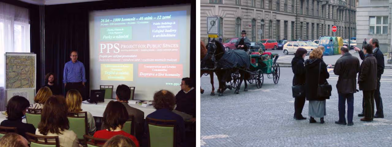
“Start with the Petunias” became “Začněte s petúniemi” when we launched our first international program in the Czech Republic in 1994, with the support of the Rockefeller Brothers Fund and the German Marshall Fund. After the fall of communism in 1989, local governments were struggling to find ways to engage local communities. The Mayors of historic Czech towns didn’t just want planning, they wanted concrete results (“concretni”). Thankfully, we had funding not only to facilitate a visioning process with communities to improve their public spaces but funding for implementation, which was modest by American standards, but went a long way in those days. This program became a model, and as we expanded it throughout Eastern and Central Europe, How to Turn a Place Around, the Place Diagram, and the Place Game were translated into Czech, Polish, Hungarian, Russian, and Albanian.
Later, our friend and colleague in London, Eric Reynolds, coined the term “Lighter, Quicker, Cheaper” to define a different model of real estate development using light structures and temporary uses, often in the form of markets. He kindly allowed us to appropriate the terms for our use. That’s how “Start with the Petunias” became a campaign for “Lighter, Quicker, Cheaper” placemaking, which took off alongside its sister term “tactical urbanism” after the 2008 recession.
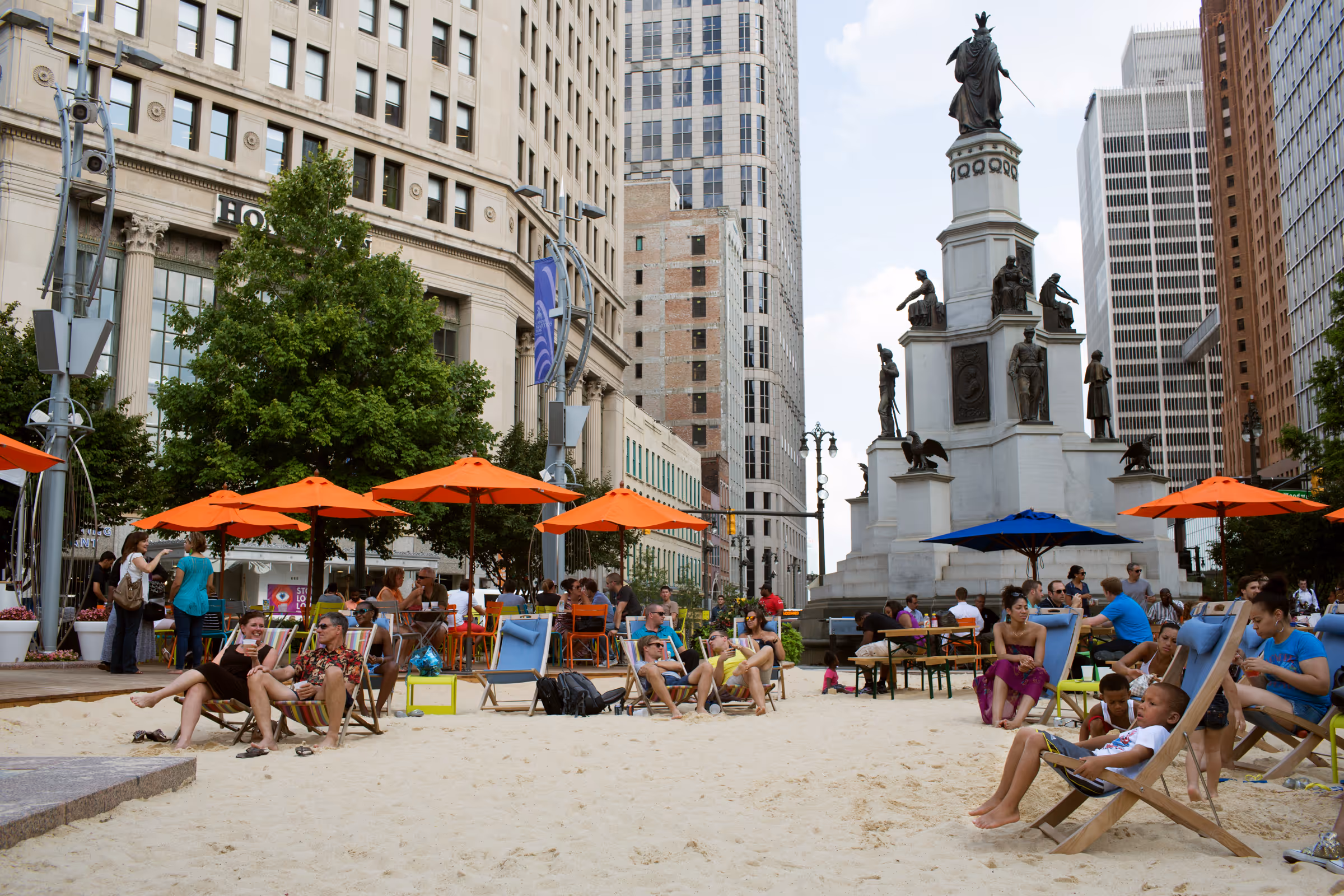
Some of the projects we are most proud to have led over the years can be found in Detroit, including Campus Martius Park and Eastern Market. In 2013, we took Lighter, Quicker, Cheaper (LQC) to new levels in downtown Detroit and neighborhoods throughout the city. With the support of the Kresge Foundation and the W.K. Kellogg Foundation, we first focused on LQC improvements in neighborhood farmers markets and a local fresh food shop, Peaches ‘N Greens. We then moved on to low-cost improvements in a dozen neighborhood public spaces throughout Detroit, where community groups applied for small grants that came with our technical assistance and support from Community Development Advocates of Detroit and the Renaissance Center. The Center’s owner, General Motors, announced last year that it is moving to the center of downtown, where the action is, and the new developer is tearing down part of the complex that has become functionally obsolete. As public spaces continue to evolve, may we never underestimate the power of petunias!
This principle is a direct Hollyism, as he wrote in The Social LIfe of Small Urban Spaces: "Triangulation is the process by which some external stimulus provides a linkage between people and prompts strangers to talk to other strangers as if they knew each other." With Holly’s definition of triangulation, spontaneous social contacts occur as people watch a street performer—or when all the lights go out on the subway and it stalls in a tunnel. The subway is a very social space then!
Unfortunately, we now know that there is an epidemic of loneliness in America, which means there is also a dearth of triangulation.

Through our projects, we often introduced triangulation into a space. Examples include the holiday tree in Campus Martius, whose lighting attracts 100,000 people, or the jumping fountain in Discovery Green—with its adjacent cafe where parents can socialize while they watch the kids. Understanding triangulation was also key to our work in public markets. We realized that markets create countless triangulation opportunities between vendors and customers (as they made a transaction) and between customers and customers (oohing and aahing over the produce). Not surprisingly, studies have shown that markets have significantly more social interactions than supermarkets.
Over the years, we expanded the definition of triangulation to include the way that locating uses or amenities near each other can generate additional use of all kinds. This idea came from our early observational work, including a national study of how people use bus stops. The best bus shelter we observed then was in Portland, Oregon. Here, the bus shelters had seating, leaning rails, and information, and nearby there was even more seating under trees and the bus sign. The bus waiting area was so much more than just the shelter.

The worst shelter we studied was on the State Street Transit Mall in Chicago, which had no protection from the winds of the Windy City, and people cowered in front of store windows, blocking access. “Great Street, Bad Mall” read the article headline by a reporter who followed us around. This press did not please local officials, but the sentiment was true—and the reason why the shelters and the mall were later ripped up and the street put back years later at significant cost.
Today, designers still often overlook the role of triangulation, from everyday parks to the fanciest award-winning plaza, where the collection of features fail to add up to more than the sum of their parts.
One of Yogi Berra's great sayings is, "If they say it can't be done, it doesn't always work out that way," and we found it appropriate for our work. Acknowledging obstacles at the outset of a project (in a humorous way) actually seemed to help break down obstacles because people saw them coming, and it opened up dialogue with bureaucrats about whether these obstacles made sense or not.
It’s impossible to list all the arbitrary bureaucratic barriers created in cities to prevent good places. (But you can get a taste of them from Project for Public Spaces’ recent State of Public Space report!) In the early days, we attempted to deal with these obstacles by collecting data in new ways. One of our early innovations was to study the number of people moved by each lane and sidewalk on Fifth Avenue in New York City. These charts showed that the most people—pedestrians—were crammed into the least amount of space, while a parking lane was the least used, if you count the number of people in the cars. Fifty years after receiving this information, New York City is finally widening the sidewalks on Fifth Avenue. In other words, it can be done. It just might take a while.
Here’s another example: In the 1980s, we wanted to put a market on the desolate Market Square Park in downtown Houston, once the home of the market and the city's original city hall. But the space had been given to the parks department, which said you couldn’t put economic activities in a park. We had to wait another 20 years to bring this idea to fruition, but it’s one of the great places in Houston today!
One of our favorite examples of breaking down barriers was in downtown San Bernardino, California. Participants in a workshop described all kinds of ways to make a more lively downtown, and an alarming number of these ideas, from sidewalk cafes to sandwich boards to street vendors, were apparently illegal. With the city’s agreement, we created an informal “Bureaucracy-Free Zone,” where we were allowed to simply try things. This included adding diagonal parking to slow cars on the wide streets of downtown, which remains today. We debated with the City as to whether it would fit because the street didn’t meet “standards,” so we decided to test it with our own cars. We all drove to the street and parked diagonally to see if it worked. The traffic engineer even arrived in his huge Winnebago—but it fit! It can be done.
This principle is a twist on the architectural maxim, “Form follows function,” popularized by architect Louis Sullivan. The original maxim states that the shape and design of an object should express its intended purpose or function. We changed it because, unfortunately, the forms architects designed for public spaces may have looked functional, but often didn’t actually function for the people using the space.

Form supports function means something quite different: the design form has to work for users. We learned early on that we had to prepare very explicit programs for public spaces and the uses they would accommodate, along with our concept plans, design sketches, and photos from other public spaces. Our 1980 report for Bryant Park, building on work Holly Whyte had done earlier, is a classic example of this kind of detailed program and, in the end, was followed pretty closely by the architects and designers.
In dealing with building form, we ventured into Starchitecture territory, which led to some memorable interactions! When the developer of 500 Boylston Street in Boston asked us to meet with noted architects Philip Johnson and John Burgee to discuss how we could activate a formal courtyard they had designed for a new office building, Johnson was charming and engaging, but finally he said, in the nicest possible way, “If I saw someone sitting in front of the building, I’d go in the back door.” Ultimately, we reached a compromise, and today, there are several kinds of seating right in front of that door.
Tension often existed with the designers we worked with, but this tension could be healthy and productive, if facilitated by enlightened clients. The public space transformations we are most proud of were often ones where clients played a decisive role in ensuring that form supports function. The late Bob Gregory, who was the Chief Planning and Public Space Officer at Downtown Detroit Partnership, was a master of this role, and is one key reason why Detroit’s Campus Martius is such a success, and so was Guy Hagstette, the inaugural President and Park Director of Houston’s Discovery Green. Kudos to them both.
Of course, getting things done often requires some money. But all too often, a lack of sufficient funding becomes an excuse for doing nothing or conducting another study, instead of starting small. This principle connects “Start with the Petunias” (small changes matter) with “You can’t do it alone” (partners provide resources) and “Have a vision” (money follows vision). All of these reflect our need to be resourceful in paying for project implementation.
While we had many successes in the early days, we also had many projects with great vision that never went anywhere, which is why we built in other mechanisms for implementation that didn’t depend on a major investment.
We worked on many planning projects in downtown Springfield, Massachusetts, in the 1980s with a great client and enthusiastic stakeholders. But looking back, the city was trying to position itself too much for new development rather than looking at maximizing the assets it already had. Sometimes, we’ve had the experience of visiting a city years after we had planned a project, and found that it was built but no one told us! That’s always a great surprise.
While fortunately somewhat less common today, cities often build or renovate a public space at great cost, host a ribbon cutting, and then let the space decay until the process has to be repeated. We know that public spaces evolve and need to be nurtured—and repaired—over time. They require diligent, ongoing management to program and activate the space. This was not a widely understood concept in 1975.
During the financial crisis in New York City in the 1970s, public spaces had declined to such a state that nonprofits and business groups had to come to the rescue. The city became an incubator for conservancies and business improvement districts and other ways the community could support, supplement, or even replace what the city could no longer afford to do. The Central Park Conservancy was founded in 1980, and the Union Square Partnership (around Union Square Park) became the first Business Improvement District in New York City in 1984.
In 1980, we were working on a project in downtown Hartford, Connecticut. The downtown was still vibrant, with many independent businesses and two department stores. Our first presentations, a Super 8mm film of how people were using the downtown and some ideas for improvement, did not go well. The merchants were adamant that nothing could be done until “somebody” cleaned up the litter and emptied the trash receptacles. We went back to our office in New York to regroup, and drew a map of downtown showing the boundaries of a new “Downtown Management District.” It became a reality in 1982, led by Rich Bradley, who later went on to direct the International Downtown Association and the Downtown D.C. Business Improvement District.
Meanwhile, across the country, our friend Dick Fleming was named head of the Denver Downtown Partnership, which in 1982, was designated to manage the new 16th Street Mall designed by I.M. Pei. Together, the two projects were how we incubated the big idea behind this principle. We also researched what other downtowns were doing to improve the management of their spaces, summarized in Managing Downtown Public Spaces, published with the Urban Land Institute in 1984. We went on to help scores of downtown organizations across the country expand their marketing efforts to include maintenance, security, programming, and design of public spaces. Eventually, the ideas became established, and as with other innovations we helped to initiate, we went on to other things.
Still, we like to say that 80 percent of a public space's success is due to its management. Successful projects, they say, have many parents. In our case, we can take credit for many great public space start-ups, but it is the management teams that “raise” a public space on an ongoing basis, and deserve 80 percent of the credit.
In closing, let’s say that our work, too, is never finished. Today, Project for Public Spaces, as well as our new initiatives at Placemaking X and the Social Life Project, continue to build upon these 50 years of lessons, experiences, and relationships. We hope this work will inspire communities and transform cities for the next 50 years.
Happy 50th Birthday, Project for Public Spaces! And many, many more!

Add How to Turn a Place Around to your library! The second edition of the book that has inspired the placemaking movement since 2000 features new tools and case studies to help you implement effective changes in your community.
Proceeds from your purchase go directly to support Project for Public Spaces. Click here to get the ultimate placemaker's guide and inspiration for yourself or a placemaking friend today!
The rich text element allows you to create and format headings, paragraphs, blockquotes, images, and video all in one place instead of having to add and format them individually. Just double-click and easily create content.
The rich text element allows you to create and format headings, paragraphs, blockquotes, images, and video all in one place instead of having to add and format them individually. Just double-click and easily create content.
Body Text Body Link
The rich text element allows you to create and format headings, paragraphs, blockquotes, images, and video all in one place instead of having to add and format them individually. Just double-click and easily create content.
Here is some highlighted text from the article.

Headings, paragraphs, blockquotes, figures, images, and figure captions can all be styled after a class is added to the rich text element using the "When inside of" nested selector system.
Headings, paragraphs, blockquotes, figures, images, and figure captions can all be styled after a class is added to the rich text element using the "When inside of" nested selector system.
Headings, paragraphs, blockquotes, figures, images, and figure captions can all be styled after a class is added to the rich text element using the "When inside of" nested selector system.

We are committed to access to quality content that advances the placemaking cause—and your support makes that possible. If this article informed, inspired, or helped you, please consider making a quick donation. Every contribution helps!
Project for Public Spaces is a 501(c)(3) tax-exempt organization and your donation is tax-deductible within the guidelines of U.S. law.
.avif)