The Placemaking Round-Up
A biweekly newsletter with public space news, resources, and opportunities.
The Biweekly Bazaar
A curated dispatch on all things public markets plus the latest announcements from the Market Cities Program.
A biweekly newsletter with public space news, resources, and opportunities.
A curated dispatch on all things public markets plus the latest announcements from the Market Cities Program.
Editor's Note: This article is the third in a four-part series that explores the four segments of the Place Diagram, which answers the question, “What Makes a Great Place?” Read the first article on Uses & Activities here and the second on Sociability here. To learn more about placemaking, check out our upcoming events and trainings.
When Frederick Law Olmsted conceived of Boston’s Emerald Necklace, access and linkages was at the heart of the renowned landscape architect’s vision. The seven-mile network of linear parks and greenways, built in the late 1800s, created an endless loop for residents to interact with nature, their city, and each other. Olmsted understood then what holds true today: the public realm is devalued if distant.

Accessibility is assessed through these varying degrees of connection. Is a place a part of its surroundings, both visually and physically? Is it easy for people to travel to? Can you see it from afar, and up close? What’s it like when you’re there? Surely we prefer walking down a lively street over one devoid of activity, and that’s part of it. But it’s also a matter of how we get there, and how we even find out about it in the first place.
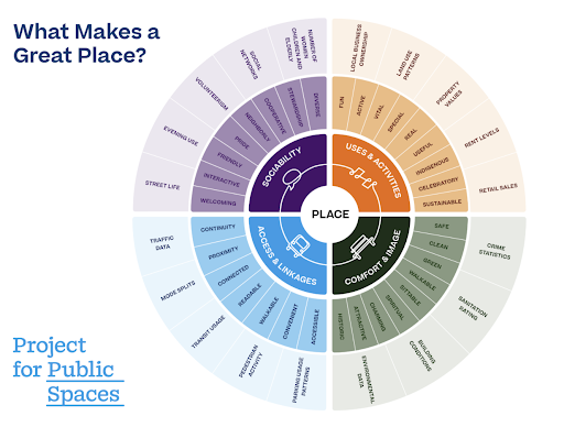
Access and linkages is one of the four pillars that make up the Place Diagram, a visual representation of what constitutes a great public space. This article examines how to find opportunity in inactivity, make room for various modes, and ensure that connectivity is felt by all.
After decades of car-centricity, cities are covered in liminal spaces, like underground passageways, freeway overpasses, and bridge underpasses. Infrastructure meant to expand access for automobiles has imposed the opposite on everyone else. Although cities continue to pursue these projects, they face a reckoning: for the first time, the USDOT is applying new criteria and funding to rethink disruptive past planning decisions, following local leadership.

Not all municipalities have the political support or funding to tear down a highway. But there are other ways to bring color to gray areas, says Project for Public Spaces’ Director of Projects Elena Madison. It just has to make sense where it is. “Using highway space is hard because it’s not built for people,” says Madison. “You really have to make that space welcoming.”
That starts with visibility, which beckons curiosity. “Having a visual connection to space is very important because we’re visual creatures,” says Madison. “You need to see something to know that you can go there and enjoy it, that there’s something to do, that it’s safe, accessible, and inviting.”
In San Antonio, Texas, the unwelcoming area underneath the city’s elevated highways had created a barrier between the University of Texas San Antonio’s campus on one side and a market square on the other. But with its shade from the summer sun, planners also saw the site as an ideal place to potentially revive. “There were actually two major destinations for people to connect,” added Madison.
Youth quickly became the driving force of design behind what is now known as The Pass. At brightly painted basketball courts and ping-pong tables, college students intermingle with teenagers, a group often overlooked in public space conversations. A former dividing line, the recreational space is a first for San Antonio, through an agreement with the Texas DOT. Other examples, like Miami’s The Underline and Toronto’s The Bentway, show an emerging pattern.

“You have this whole new crop of younger transportation engineers and planners coming in,” Madison says. “They understand how important this infrastructure work actually is to creating a place and neighborhood, but also, potentially destroying it.”
As San Antonio Councilwoman Teri Castillo put it, “This park gives us an opportunity to reconnect our communities to shoot some hoops, rally over some ping pong, and spend quality time together under a structure that was once historically used to separate us.”
In Jackson Heights, Queens, the newly minted Paseo Park added 20 blocks of calm streets and car-free plazas to one of New York City’s most space-starved communities. Paint on “shared streets” helps put two feet and four wheels on equal footing; curb extensions, boulders and chicanes help slow cars; and a set of dead-ends and traffic reversals maintains vehicular access, although it may take a bit longer. The result resembles a fietsstraat (Dutch for ‘cycle street’) whose sign famously reads: auto te gast. “Cars are guests.”

When we talk about access, it’s vital to ask the question, “For whom?” Spaces that prioritize one form of mobility play favorites, and cars receive outsized preference, even though ownership, storage and operation all create a high cost of entry compared to other modes. A great public space is enjoyed by a diversity of users when it can be accessed in a diversity of ways—walking, rolling, cycling, micro-mobility, and driving.
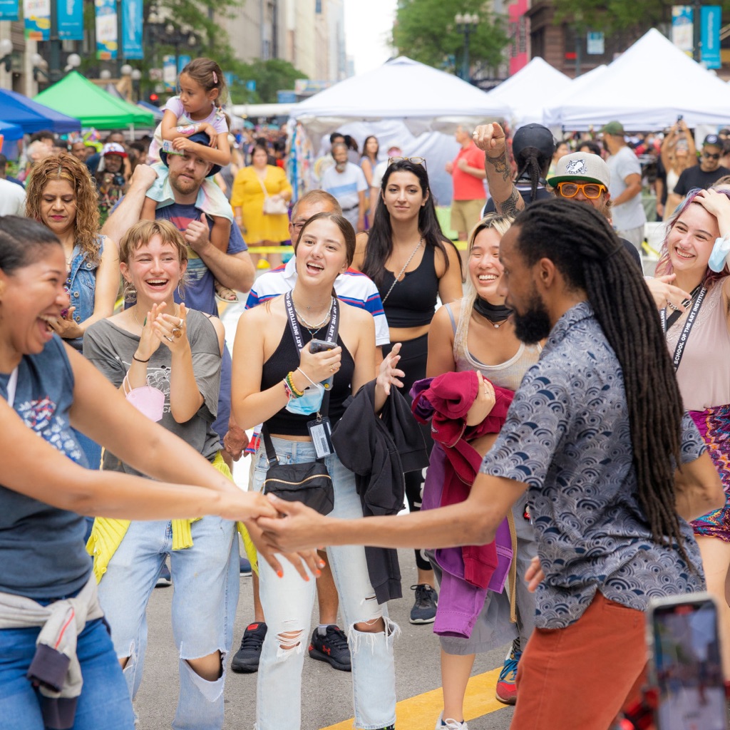
But that goal always has to contend with context. In 2021, the Chicago Loop Alliance introduced “Sundays on State,” a weekly activation that closes State Street, a main downtown corridor, to cars for pop-up fairs and public use. Now in its third season, a key to the popular program’s enduring success is the numerous points of entry, so businesses can still get deliveries and visitors with accessibility issues can enjoy it as well.
Frankye Payne, the director of Chicago Main Streets, says that tuning up infrastructure to be more multi-purpose expands a space’s reach. Most of the time, a large chunk of our public realm portfolio has a singular use: car access or storage. But a few design tweaks can help balance the scales towards people.
A parking garage Payne encountered in Oakland County, Michigan, was a telling example. The uncovered top floor sometimes doubles as an outdoor theater and market. “The municipality has tried to acknowledge that this footprint can be a bit of an eyesore,” she says. “How can they remix that in a way where it has a more intentional use, with activities beyond just parking?”

Those conversations are especially acute in disinvested communities, says Payne. When Covid-era restrictions were enacted, it was a visceral reminder of the disparity in access to resources. Since then, local leaders have continued to get creative.
“Communities want to have that outdoor space flip from loading or parking to tables and chairs, to really get people to come and participate,” Payne says. “There’s this amount of flexibility that allows you to think of the capacity over time for what this space could be when it’s not in use. I don’t think that was considered before.”
People typically spend a short period of time in public spaces, a transience crucial to the experience. This phenomenon is pronounced in transit hubs: the minutes before a train, the wait for a bus, the brisk walk to a connection. It’s active by nature, and seamless linkage to destinations is the intent. But it doesn’t have to be the only one.
In Atlanta, Georgia, the North Avenue MARTA station is typical of late 20th century public transit: an exposed aggregate concrete building next to a plaza with sparse seating. The train-bus layover hums with daily traffic, as students from Georgia Tech shuffle in alongside Midtown’s office workers and residents.

“Depending on how good the transit is in that city, people often spend some time waiting for the bus or the train,” says Madison. “That is a huge opportunity to bring other activities, so the station can become a whole experience.”
Soon, public art will touch up the concrete and a container stage will host performances, creating opportunities to involve nearby students. With no proximate public parks, the space’s purpose, once finished, will shift from on-the-go to wait-and-see. Transit hubs are the perfect places for that.
“There is a reason why a lot converges there. We connect there and it feels a lot more open and non-judgmental. The barrier of belonging is low: you don’t need a reason to be there,” says Madison. “This creates places for people because, at the end of the day, all these places are about people connecting to each other. So why not?”
Public spaces have public images. Perceptions inform usage—experiences create impressions that either hinder or expand access. Signage and advertising can help build an inviting persona through friendly language and information, both online and "IRL." But the built environment must follow through.

In Waco, Texas, the 500,000 annual visitors to its Magnolia Market at the Silos often do not realize that downtown is just a few blocks away. This was partly because the journey entailed uninviting alleyways and dangerous intersections. The City asked CivicBrand, which helps build marketing campaigns for open spaces, for guidance on linking the two.
“We visited and said, ‘You really have more of a public space problem,’” says Layne Ferguson, the director of placemaking at CivicBrand. “Of course people aren’t walking there. Everything about this space tells them not to do that.”

The company worked with the City to enliven a pedestrian walkway and plaza, using tactical measures to connect one destination to another. Pedestrian counts shot up 30 percent after implementation, and traffic speeds went down 23 percent. It helped knit together an urban lattice by redefining how one saw it in the first place.

“If you can change the narrative towards not this one destination, but the place or the whole environment,” says Ferguson, “it changes how someone explores that area, and hopefully spends time there.”
Olmsted’s choice of the phrase "Emerald Necklace" is meant to evoke the image of a metaphorical string of jewels laid out across Boston, green steps along a larger path.
If we think of our public spaces like a transit network, as interconnected as a metro or bus system, then access and linkages appear clearer. It’s less about the spaces that we go through, but rather, the spaces we go to. And, hopefully, stay a while.
John Surico is a writer and researcher who focuses on mobility and open space. He teaches at New York University’s Arthur L. Carter Journalism Institute, and is the scholar-in-residence at Central Park Conservancy’s Institute for Urban Parks. He is a lead organizer with the 31st Avenue Open Street in Astoria, Queens, where he lives, and is the author of Streetbeat, a newsletter on cities and how they’re changing.
P.S. Need additional help with a public space? Project for Public Spaces offers technical assistance to clients in the public, civic, and private sectors that seek to support the wellbeing of communities through public space. Learn more and view recent projects.
The rich text element allows you to create and format headings, paragraphs, blockquotes, images, and video all in one place instead of having to add and format them individually. Just double-click and easily create content.
The rich text element allows you to create and format headings, paragraphs, blockquotes, images, and video all in one place instead of having to add and format them individually. Just double-click and easily create content.
Body Text Body Link
The rich text element allows you to create and format headings, paragraphs, blockquotes, images, and video all in one place instead of having to add and format them individually. Just double-click and easily create content.
Here is some highlighted text from the article.

Headings, paragraphs, blockquotes, figures, images, and figure captions can all be styled after a class is added to the rich text element using the "When inside of" nested selector system.
Headings, paragraphs, blockquotes, figures, images, and figure captions can all be styled after a class is added to the rich text element using the "When inside of" nested selector system.
Headings, paragraphs, blockquotes, figures, images, and figure captions can all be styled after a class is added to the rich text element using the "When inside of" nested selector system.

We are committed to access to quality content that advances the placemaking cause—and your support makes that possible. If this article informed, inspired, or helped you, please consider making a quick donation. Every contribution helps!
Project for Public Spaces is a 501(c)(3) tax-exempt organization and your donation is tax-deductible within the guidelines of U.S. law.
.avif)